ABOUTDEVELOPERS
|
ParcelStream™: Turn-Key Parcel Boundaries for Online Mapping
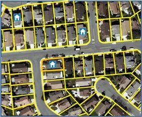
With only a few lines of code, you can instantly display parcel lines, geocode addresses to parcel centroids, connect related data to parcels, and achieve interactivity with parcel lines. ParcelStream® is a turn-key solution for integrating parcel boundaries into mapping applications.
ParcelStream® also offers spatial data integration solutions that automate the process of matching related data sets so you can easily add interactive mapping features and gain more value from your data assets. For instance, with ParcelStream® you can link spatial and tabular data sets such as property records and parcel boundaries. Exploring ParcelStream®The resources listed below will help you learn more about ParcelStream®, see its web services in action, and even try it out for yourself in your own application.
Digital Map Products' ParcelStream® is the most comprehensive parcel boundary solution available and is the parcel solution of choice for national real estate websites. Experience the ParcelStream® difference today and take your mapping application to the next level. |